Buy your GR3, TER train trail topographical guide
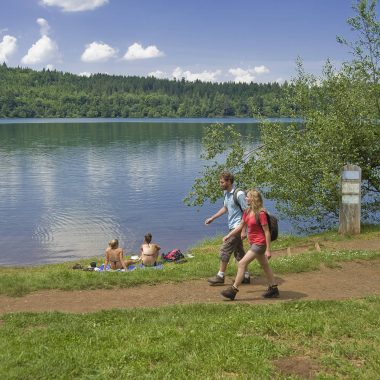
Hiking in the Loire Gorges
Vorey is at the confluence of the River Loire and the Arzon, where the landscape narrows to the Loire Gorges, leading to Monistrol.
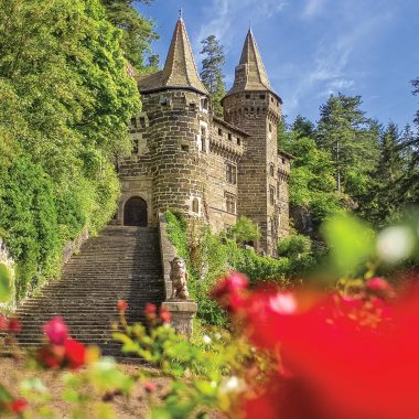
Lavoûte-sur-Loire is a little village named after an unusual loop in the river. It has the “first chateau on the Loire”, the Lavoûte Polignac chateau. The building was the home of the great Polignac family and looks down over the river.
Between the two towns is the Emblavez plain, the historic name of farmland that was the granary of Haute-Loire, with volcanic peaks and wide-open spaces.
From Vorey or Lavoûte, set off for 27.5 or 16 km to get to Le Puy-en-Velay, the crossroads for several major hiking trails. The climb up the Suc de Ceneuil and the ascent towards La Roche and Rachat feature some superb panoramas before you arrive in Chanceaux. As the miles go by, the Velay region comes into sight with the imposing Polignac fortress in the distance.
GR3 for a day
GR3 for a day
The Loire is your guide all the way to Le Puy-en-Velay
You will go through the unusual village of Polignac, where the houses are built all around a rock crowned by the Fortress. You are now at the gates of Le Puy-en-Velay, but this is not the last time you’ll be needing a head for heights.
From Plaine de Rome you can look down on all the Puy-en-Velay basin before arriving in Aiguilhe. Here is the proud and majestic Saint-Michael’s rock, a 82-metre-high volcanic peak with the Saint-Michel d’Aiguilhe chapel at the top.
The hike concludes in the little streets of Le Puy-en-Velay and its preserved historic sector, before you go down to the lower town to enjoy a well-deserved and refreshing drink at a cafe terrace.
The route in a nutshell
From Vorey: 27.5 kilometres, about a 7-hour walk
From Lavoûte-sur-Loire: 16 km, about a 4-hour 30 minute walk
Maximum altitude: 850 m – Minimum altitude: 530 m
The sections:
Vorey > Lavoute-sur-Loire: 11.5 km
Lavoûte sur Loire > Polignac: 9 km
Polignac > Le Puy en Velay: 8 km
Departure: from either SNCF train station
Signage: red and white (GR3 trail)
TER train times – Le Puy-en-Velay / Saint-Etienne line
Our tip: always set off by train and come back on foot. You will be more relaxed without having a set time to get back. If you want to go the whole way, catch the train at about 8 in the morning in Le Puy. If you want to do the 16 km from Lavoûte, you can take the train at Le Puy station at about 12.45 p.m. (See the exact train times below).