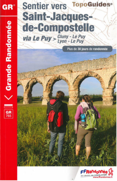
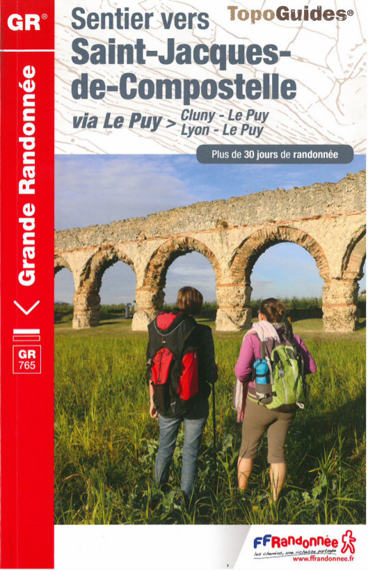
Buy your Way of Saint James topographical guide
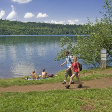
The Cluny Way (Chemin de Cluny) goes through Le Puy-en-Velay, the historic departing point along the Way of St James. It is a route that is rich in heritage and wonderful scenery. With famous wine regions and medium-altitude mountains, the trail then follows the Loire valley with a chance to see the vestiges along the Way of St James.
From the Burgundy-Franche-Comté region, and more precisely, Saône-et-Loire, the route first takes in the landmark town of Cluny with its large medieval abbey church. It then runs through the hills of Beaujolais, before winding its way across the slopes of the Roanne vineyards and the Forez mountains and arriving at the town of Le Puy-en-Velay through the Loire gorges. Hikers can then continue their pilgrimage towards Santiago de Compostela via the Puy-en-Velay Way.
The Cluny Way,
exploring Saône-et-Loire
The abbey of Cluny is the starting point for hikers preparing to set off along the Way of St James. The route is an easy one until the village of Sainte-Cécile, where it rises to a follow a crest between the Grosne and Valouzin valleys.
Cluny abbey © Ibanez Aurélien
Cluny abbey - © Givord Véronique
The trail features some wonderful panoramas before arriving in the Rhone department, including the hilltop village of Tramayes. From Cenves, you make your way to Saint-Jacques-des-Arrêts with its fine church. This is a regular stop for pilgrims, with a permanent exhibition of paintings by Jean Fusaro, a lyrical and figurative French artist. A few miles further on you arrive in Ouroux for a well-earned break!
The town of Cenves © Office de Tourisme Beaujolais monts et vignoble
Fusaro's painting © Office de Tourisme Beaujolais monts et vignoble
The little town of Ouroux © Office de Tourisme Beaujolais monts et vignoble
Essential
The IGN (Institut National de l’information géographique) map, description of the route, a list of available accommodation, restaurants, a wide range of practical services, introduction to the landmarks and landscapes and a topographic guide. A light and easy map to carry in your bag, and the essential guide to guarantee perfect peace of mind!
Between the Rhone and the Loire
The Rhone stage leaving from Ouroux runs mainly through a natural environment, in the forests, with a striking section on the “roof of the Rhone”. This is Mont Saint-Rigaud, at an altitude of 1009m, with wonderful panoramas over the Green Beaujolais. The source here is said to have miraculous properties… After passing La Croix du Pendu and the Col de Crie, you arrive at the village of Propières.
Saint-Rigaud Mount ©Office de Tourisme Beaujolais monts et vignoble
Propières Lake ©Office de Tourisme Beaujolais monts et vignoble
The Col de Crie House ©Office de Tourisme Beaujolais monts et vignoble
After 3 km, the Col des Echarmeaux (712 m above sea level) opens up a panorama across the Azergues Valley. Filled with ascents and descents, the trail goes over the Col des Aillets (715m), the Col des Ecorbans (825m) and the Col de la Bûche (683m). After this “mountain” stage, the arrival in the village of Le Cergne signals a new episode, since you are now in the Loire department!
It’s time to go down towards Charlieu! This is a small town near the Loire with a fragrance of French history, thanks to its famous 9th century Benedictine abbey.
Charlieu abbey
Charlieu abbey
The Cordeliers convent, Saint-Philibert’s church and the Silk Museum in an 18th century building are also well worth a visit.
Cloister of the abbey
The Cordeliers convent
Saint-Philibert's church
The town of Charlieu ©OT Charlieu Belmont
On the way to Forez
Charlieu signals a new starting point on the trail to Le Puy-en-Velay along the Cluny Way. Here we arrive in the land of the Rhone. First we head for Saint-Haon-le-Châtel or Renaison (2 km apart). The beginning sets the tone with the 12th century Bénisson-Dieu Abbey. This Gothic-style abbey is covered in varnished tiles. It was founded in 1138 and named Our Lady of the Benediction of God.
Bénisson-Dieu Abbey
Bénisson-Dieu Abbey
Bénisson-Dieu Abbey ©OT Charlieu Belmont
Next up is the little medieval town of Saint-Haon-le-Châtel. Nestling in a green setting on the foothills of the Monts de la Madeleine, the town is a real open-air museum! For the most energetic hikers, the stage can continue on to the town of Renaison, a few miles further on.
The town of Saint-Haon-le-Châtel ©Evelyne Deveaux
Medieval town of Saint-Haon-le-Châtel ©Evelyne Deveaux
Renaison - Barrage ©Evelyne Deveaux
After a good night’s rest, we set off again towards Saint-Jean-Saint-Maurice. After Renaison, the route passes through the Côte Roanne wine region. The local wine is made from grapes growing on land that is well-exposed to the sun. The hills are a chance to enjoy some striking landscapes before we arrive at the plain and the Loire Valley, at the village of Saint-Jean-Saint-Maurice.
The Côte Roanne wine region ©Evelyne Deveaux
The Côte Roanne wine region ©Evelyne Deveaux
The Côte Roanne wine region ©Evelyne Deveaux
Essential
The IGN (Institut National de l’information géographique) map, description of the route, a list of available accommodation, restaurants, a wide range of practical services, introduction to the landmarks and landscapes and a topographic guide. A light and easy map to carry in your bag, and the essential guide to guarantee perfect peace of mind!
The pilgrims continue on their way a few miles from Lake Villerest, south of Roanne. Saint-Jean Saint-Maurice has a great hilltop view over the River Loire. La Cure welcomes pilgrims on the Way of St James in a magnificent setting. Leaving from the village’s Romanesque church, the route is hilly as far as Bully, where the old houses were built from golden stone. We arrive at the town of Saint-Germain-Laval, built on the mountainside and looking down on the Forez plain.
Villerest Lake ©OTRA Office de Tourisme Roannais Agglomération
The town of Saint-Jean Saint-Maurice ©Roannais Agglomération
The town of Saint-Jean Saint-Maurice ©Roannais Agglomération
A descent alongside the winding River Aix awaits us next day and leads to the village of Pommiers with its Benedictine priory. The trail continues through an area of lakes before arriving at the town of Montverdun. The priory is listed as a “Historic Monument” and rises on a basalt peak that is 20 million years old.
Arthun ©OT Loire Forez
Arthun ©OT Loire Forez
Priory of Montverdun ©OT Loire Forez
Montbrison is not far away. This town in the Forez plain is the second stop on the Cluny Way, after Charlieu. A shorter stage combining plains and hills comes next, leading us to the town of Champdieu, a charming village with a remarkable priory and Romanesque church.
Champdieu church ©OT Loire Forez
Champdieu church ©OT Loire Forez
La Porte de Bise in Champdieu ©OT Loire Forez
Virgin Mary in Champdieu ©OT Loire Forez
We arrive at last at the historic town of Montbrison. Take the time to explore a town that is rich in history and heritage, and includes the Notre-Dame d’Espérance collegiate church. The Cordeliers convent today is the Town Hall, but you can also visit the museums or try the local specialities. At Montbrison market you will find Forez farm produce and a friendly atmosphere, with a chance to taste the famous Fourme de Montbrison cheese!
The city of Montbrison ©OT Loire Forez
The city of Montbrison - Vizezy dock ©OT Loire Forez
The Loire gorges,
destination Velay
From Montbrison, you set off towards Le Puy-en-Velay through a wide range of fine landscapes, including forests and high plateaus. You reach the limits of the Forez region and arrive in Moingt. A wonderful panorama awaits hikers from the Romanesque chapel of Montsupt. As you go through the village of Lézigneux, you can take a break and admire the Vidrieux lake. A little path finally brings us to the village of Marols.
Lézigneux - Vidrieux Lake ©OT Loire Forez
Marols ©OT Loire Forez
Marols ©OT Loire Forez
The route to Le Puy-en-Velay continues through the forest as far as the village of Montarcher, with a great view over the Velay and the Vivarais regions. This was a Celtic route named the Bolène Way, linking Toulouse and Lyon in the Roman period. A few ancient remains can still be seen along this part of the Way of St James. Twenty kilometres after Marols, you reach Leignecq for the start of the next stage.
Montarcher cross ©OT Loire Forez
Montarcher ©OT Loire Forez
The little town of Leignecq ©OT Loire Forez
The River Andrable leads you into the department of Haute-Loire. That’s right, after the Saône-et-Loire, Rhone and Loire departments, you have arrived in the region whose is capital is Le Puy-en-Velay. The hike along the River Andrable is a chance to see the vestiges of numerous windmills. The Vignal windmill is still standing and is one of the region’s main tourist attractions, in the village of Apinac.
Now you are in Haute-Loire! From the town of Valprivas, the Ance Valley and the Loire gorges wind their way to Retournac with its outstanding Lace Museum. The collection includes 450,000 pieces with 100,000 different models.
The valley of River Loire next to Chamalières
After Retournac, we head for the Loire gorges along the winding paths leading to Le Puy-en-Velay. But first, a little history and culture, as we pass by such ancient fortresses as Artias Castle, one of the oldest in Velay. Chamalières-sur-Loire with its magnificent church is not far away.
Artias castle in Retournac ©Luc Olivier
Artias castle in Retournac ©Luc Olivier
Chamalieres church
Your route continues towards Roche-en-Régnier. The old town centre and tower provide a wonderful panorama.
Roche en Régnier tower
Amazing view © Luc Olvieir
The town of Roche en Régnier
The untamed River Loire and the turbulent gorges continue on their way, passing Vorey before arriving at Saint-Vincent. From there, there are only twenty kilometres or so before you catch a glimpse of the statue of Our Lady of France, on top of the Corneille rock in Le Puy-en-Velay. The route runs through hamlets and villages, then reaches the Loire and the town of Lavoûte-sur-Loire with a castle listed as a “Historic Monument”.
After La Roche, Chanceaux and one last effort, the Polignac fortress can be seen on the horizon. Now you are at the heart of Velay and its famous monuments. Further on, the rock and chapel in Saint-Michel d’Aiguilhe are like beacons marking the last few miles. From the foot of the dizzyingly high rock, you just need to go up to La Coustette, then head into Rue Becdelièvre near the Departmental Town Hall to see Le Puy-en-Velay cathedral.
Polignac fortress
Saint-Michel d'Aiguilhe chapel
The famous Puy Cathedral
The city of Le Puy-en-Velay ©Laurence Barruel
Buy your Way of Saint James topographical guide